SSECN and MITA cruising info apps, Doyle Bon Voyage, and Cuba Ho!
If I was once again in New Bern, North Carolina, about to cruise north with spring — instead of watching late April freaking snow fall in Maine — I’d certainly have the new Cruisers’ Net app loaded on my iPad and might well use it all day every day while I was still in the Intracoastal Waterway (ICW). It’s absolutely loaded with solid, well presented information, and I’m happy to add that the Maine Island Trail Association (MITA) has done something similar for my local cruising waters…
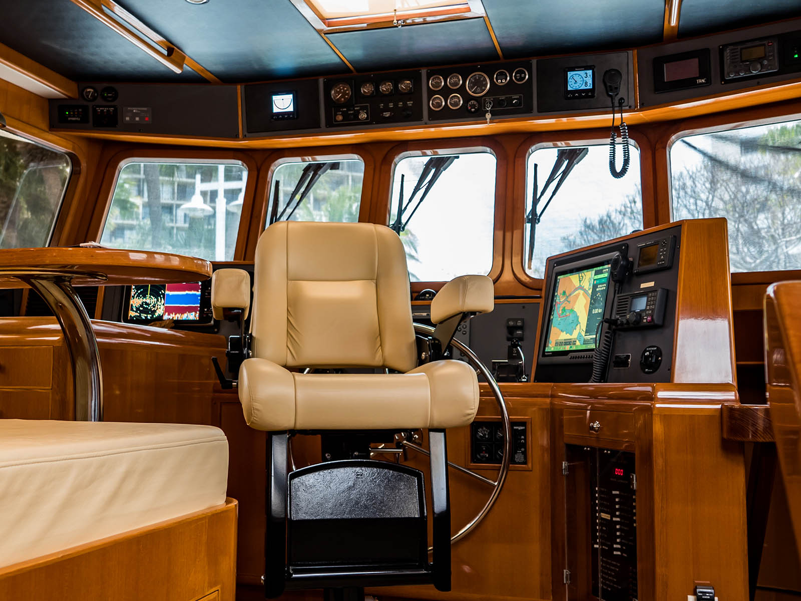
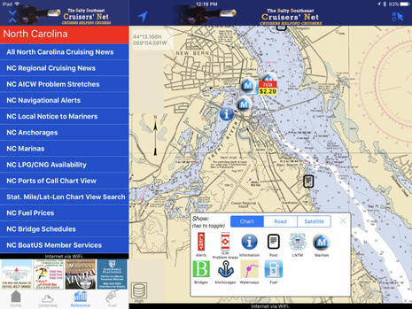
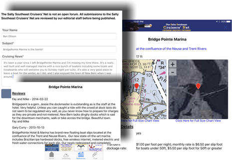 While the Salty Southeast Cruisers’ Net website has long offered a vast trove of ICW cruising info that’s edited by obviously caring professionals, the ambitious-yet-free SSECN iOS app may display all the info even better (especially on a fast iPad). In the top screen I’ve chosen the Reference list for North Carolina and opened the “tap to toggle” window to select all the available info icons that can overlay the NOAA raster charts. Then I tapped into BridgePointe Marina (above) where Gizmo enjoyed a pleasant winter fully commissioned and I enjoyed an occasional visit. Cruiser’s Net is not as busy a review site as ActiveCaptain, but you can see that “Fay and Mike” had their say and I used the app to add my 2 cents. (It went up on the Cruisers’ Net home page news feed after approval, which was a pleasant surprise as I really appreciated that marina.)
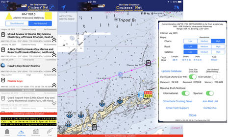
What’s really slick is the the SSECN app’s Underway mode (which includes a simulator so you can try it yourself at any time). Here I’m simulating an ICW run north inside the Florida Keys and you can kind of see how relevant info automatically appears as you approach an area and then falls astern. You can filter the info types just like you can with the overlay icons, and note that I have not well illustrated the up-to-date and researched Alerts that Cruisers’ Net is particularly good at. They also have the best fuel price info in my experience, and it’s especially well presented in the app.
Note, too, that while Cruisers’ Net is supported by advertisers hoping to get the attention of cruisers, content tilted toward advertisers is not obvious to me and, besides, I don’t think that reputable ad-supported publications work that way anymore (and advertiser influence was always exaggerated anyway in my magazine experience). Finally I collaged in the SSECN setup menu to illustrate how deep and well-made this free app is. Thank you, Cruisers’ Net!
MITA’s new Maine app
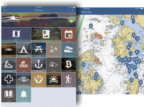
The Maine Island Trail Association (MITA) would be a fantastic non-profit organization even if it had not trailblazed a wonderful water trail movement. I’m a long time supporter in part because I treasure their annual printed guidebook, but this year they’ve put the same info and more into a terrific iOS and Android app. As you can see from the Home Page and map view above, MITA 2016 offers all sorts of data like tides, boat launches, and day use islands. Much of it is free with the app, but a whole other level of data and features becomes available if you join MITA and get the pass code.
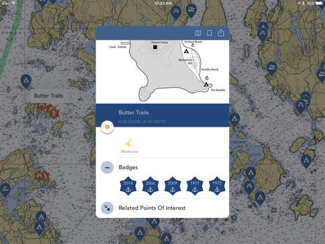 For instance, the new MITA app includes hiking maps for some islands and also lets you collect “badges” for past visits. Yes, I have been enjoying Butter Island (and thereabouts) since 1971, but what really excites me is app bookmarking islands I haven’t yet visited, and, by gosh, that includes a big one with hiking trails that’s only about nine miles away by boat and that I never realized was semi-public (MITA has such a good reputation with island owners for their “leave no trace” ethic that they often get special permissions). The MITA 2016 app also includes some good anchorage info, and smart sail and power cruisers have known for some time that the Island Trail is not just for kayakers. Thank you, MITA!
And given two excellent cruising apps from relatively small operations like Cruisers’ Net and MITA, can we hope for more? Well, it strikes me that freely available NOAA charts really help, and that may be a problem in countries where the hydrographic office budgets depend on license fees. But then again, the app building tools and skills seem to have improved a lot (and the MITA app developer Chimani seems especially adept).
Bon Voyage Diana & Mark Doyle
The amazing ICW guide work of Diana and Mark Doyle probably could have made a great app, but that’s not going to happen. After decades of cruising research and most recently producing the outstanding Guides I wrote about last September and leading the Sail ICW Rally, they just decided to close up shop, sell their boat, and go adventuring with “Other People’s Guides.” I recommend buying their print guides while it’s still possible, and I’m hoping they’ll come by my house during their RV voyages. As first a for-profit and then a non-profit — it’s about passion and integrity, not business model — the Doyles helped innumerable cruisers to better enjoy their experience, plus they’re a hoot. Thanks for your service, Diana and Mark!
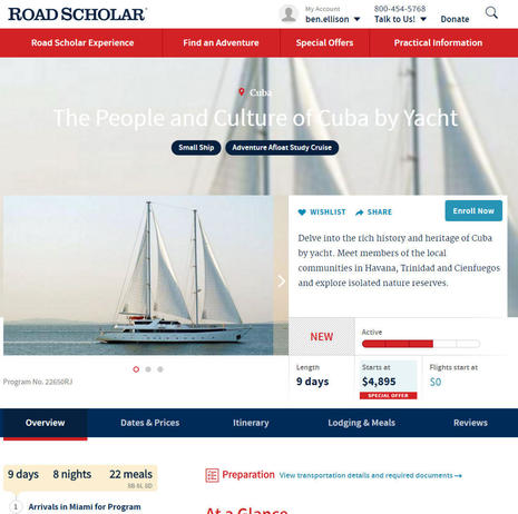
Hello Cuba with Road Scholar
 While I appreciate the Doyle “change is good” model, in fact I’d already spent a possibly silly amount of money so that the missus and I can cruise Cuba in an unusual way (for us) this June. We’re signed up for a Road Scholar People and Culture by Yacht tour and while I’m a wee jealous of friends who’ve gone to Cuba on their own boats (and I reluctantly turned down a chance to tag along on a PassageMaker Rally), I’m looking forward to the everything-taken-care-of way.
Actually, Road Scholar is an educational non-profit that used to be called Elderhostel, and we’re “second generation” because both our mothers enjoyed numerous Elderhostel trips, sometimes together. And this trip is arguably a good deal once you look into what it costs to take a more normal Panorama II cruise. In fact, there seem to be plenty of berths available if you hurry, perhaps because people (like some of my friends) think that this is a weird way to visit Cuba, though I suspect that the Cubans we meet won’t much care.
What may be truly weird for me is being offline for a solid week. I don’t know that for sure, but I am aware that I can’t even take a DeLorme InReach. I do plan to compare a variety of electronic charts and guides, though, and will report back as possible. Meanwhile, Gizmo is getting commissioned slowly — today’s was the last snow, right? — and Panbo’s new editor in Vancouver is working on some good stuff.